
Regional information update plan for flood rescue
Water levels, access roads and points of access at flood sites may continually change.
Water levels, access roads and points of access at flood sites may continually change. What the rescue team needs is not just an aerial picture at a certain moment, but an area map that can be continuously updated. The plan first marks the known water accumulation range, access roads, suspected trapped locations, and safe take-off and landing points, and then determines the focus of the repeat flight based on the speed of change, so that each new image can answer the questions that most need confirmation at the moment.
YH-2000 has a maximum load of 15 kg and a maximum flight endurance of 600 minutes, and can be used to plan continuous observation of larger areas. As a multi-rotor, YH-3000 is suitable for supplementing local perspective near suitable sites; its 30 kg load is about 30 minutes, 60 kg load is about 18 minutes, and no load is about 55 minutes. For close-range missions, observation and return times must be calculated based on actual equipment weight.
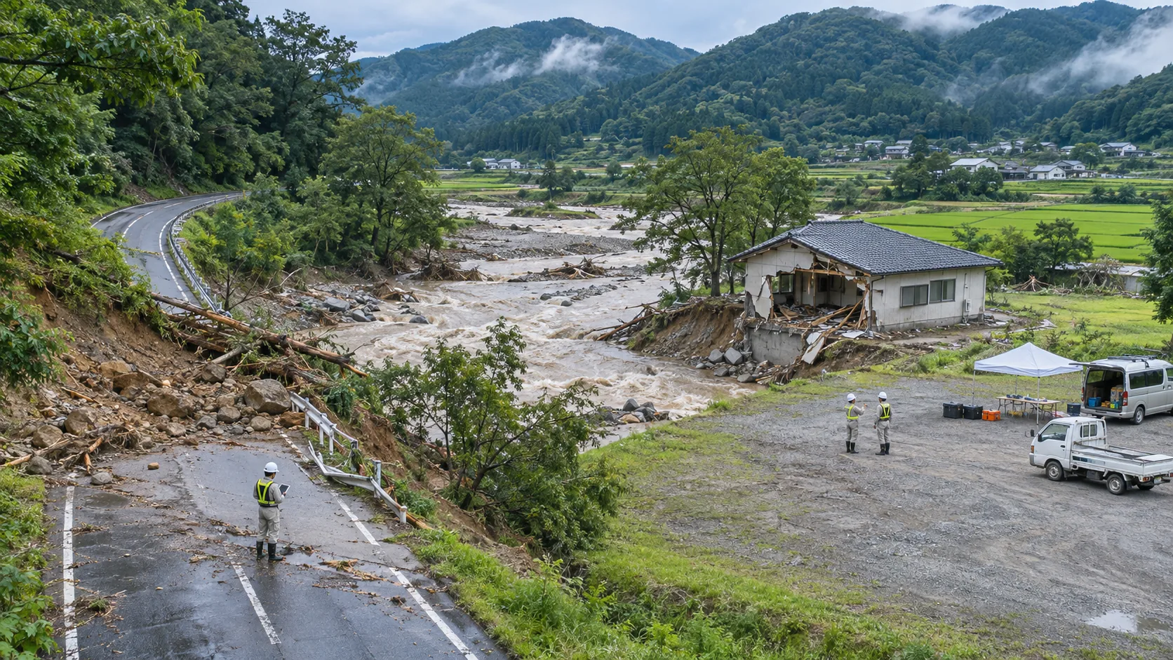
The wide-area image first updates the water surface boundary and road status, and then selects the points that need to be viewed closely. For bridgeheads, culverts or blocked road sections, it is necessary to record what the picture can explain and where it is still unclear. YH-3000's partial observations are only carried out for clear questions, such as whether it can be approached from a certain road; the final access and rescue decisions are still made by on-site personnel.
Each point uses a unified number, and the wide-area map and local image retain the same coordinates, time, and shooting direction. If the interval between the two images is long, the information update time should be indicated to avoid using expired images to arrange personnel. Areas that cannot be observed or are still subject to ground verification are marked separately and are not deemed safe just because they have been flown before.
The deliverables are a continuously revised area map, a point status table and the corresponding original images. The on-site person in charge can arrange re-viewing or ground verification based on the latest information, and backfill the results. The division of labor between YH-2000 and YH-3000 helps the team grasp regional changes and local details at the same time, focusing on allowing new information to enter rescue coordination in a timely manner.